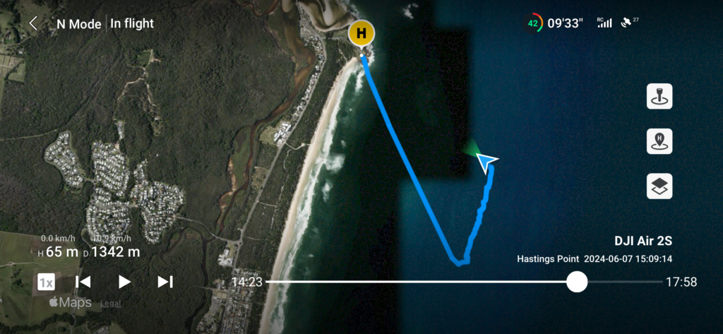
Taking videos and photos while flying the drone provides a unique perspective. No better example than capturing whales as they migrate north. The screenshot below (drone was returning from filming at this point) is the flight path & telemetry including remaining battery time/capacity; current speed; height (above my home position -“H”); distance from H (max. distance from H this flight was 1,926m); no. of satellites:27 (needs to be at least 12 for accurate GPS navigation & drone control); elapsed and total flight time; remote control signal strength etc. When flying, the flight telemetry is overlaid on the live HQ video being streamed back to me (that’s how I control/ see what the drone “sees” + 4k video capture to onboard drone SD card for subsequent editing).

… and then the editing!

